Learn to be at one with your map... Read on...
Maps are simple and easy to use however symbols can be confusing. An example of confusion is confusing boundaries with paths. One is safe to walk on. One can (in some cases) be almost impossible to walk on. So be sure to acquaint yourself with the key.
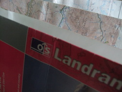
A map is essential when hiking and can easily be used to plan a hike. Find out what map you need for your area at: http://leisure.ordnancesurvey.co.uk/ Here you can also make your own map if necessary. When making or buying your map an explorer map is usually the best. Tip: When planning a hike from a map you can draw it out on your map with a grease pencil. Grease pencils are easy to rub out and should not leave a mark. Taking A Grid ReferenceGrid references are one of the simplest but essential skills in navigation as this is what you tell search and rescue so that they can determine where you are. It is easy but quite hard to explain so the explanations below may sound a bit long-winded however once you have learnt it you will find it as easy as cake...
|
ScalesConfused by map scales. Here's a simple guide...
1:50 - 1mm on the map = 50m on the ground 1:40 - 1mm on the map = 40m on the ground 1:25 - 1mm on the map = 25m on the ground 1:15 - 1mm on the map = 15m on the ground 1:10 - 1mm on the map = well you get the idea Contour lINESContour lines are those 'weird' squiggly lines that cover your map. You may think that they are for the more experienced navigator. Think again. Contour lines simply show how steep a slope is. They are spaced out at certain intervals but the distance varies with type of map so be sure to check near the key or in the top left hand corner of your map to see how far they are spaced apart. Incase you hadn't already guessed, the closer they are together the steeper the slope is. Some maps have different coloured contour lines for rocky ground. Also, if contours weren't helpful enough already the contours at milestone altitudes (such as 100m, 200m etc) tell you the altitude so it is possible for you to work out what altitude you are at. Pretty cool for some weird squiggly lines eh?
Orienting the MapYou can orientate your map by using prominent features that you can see and lining your map up with them.
If this is not possible for any reason or you would prefer to use a compass you can. Put your compass on the map. Make a note of the way the needle is pointing. Rotate the map (leaving the compass where it is until the needle is running parallel with the vertical gridlines pointing to the top of your map. Done! Digital MappingDigital Mapping includes the use of GPS devices and smartphone Apps. You pay to download a map of a certain area. However, such devices should not be solely relied upon due to possible technical failures or a dead battery. Therefore you should still carry a map and compass with you. Also you need to know how to use them!
|
 |
|